

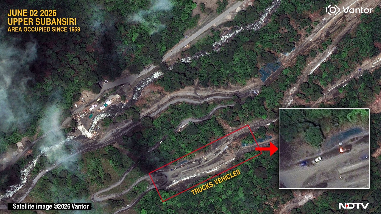
High-resolution satellite imagery has revealed a significant escalation in Chinese infrastructure development along the Tibet-India frontier. The road works are occurring in an area within the historic McMahon Line—shown on official Survey of India maps—but which has been under Chinese control since 1959, lying beyond the Line of Actual Control (LAC) physically patrolled by the Indian Army.
The Infrastructure Expansion: Linking Settlements
The newly captured imagery details a strategic road network connecting two distinct Chinese frontier habitations in Arunachal Pradesh’s Upper Subansiri district:
-
The 2021 Settlement: A village consisting of roughly 50 structures first identified in 2021.
-
The 2026 Settlement: A brand-new village built 9.42 km to the west of the older settlement.
-
The Connective Network: A freshly excavated and partly paved road network now links these two hubs. The network features multiple branches, with some routes extending directly toward the perceived border with India.
While the bulk of these settlements sit on uncontested Chinese territory, certain components—including a cement construction plant, a basketball court, and two helipads—appear to sit within India’s original claim-lines. However, due to a lack of official demarcation, exact border alignment remains a subject of “cartographic ambiguity” across global mapping datasets like Google Maps.
Strategic Impact & Local Concerns
The developments come at a time of heightened local anxiety. Earlier this week, a welfare society representing the indigenous Nah tribal community submitted a memorandum to local authorities. They alleged that China’s People’s Liberation Army (PLA) has incrementally occupied ancestral hunting, grazing, and agricultural lands over the last six years.
“India is confronting a sustained Chinese campaign to incrementally redraw the Line of Actual Control by constructing military outposts and militarised frontier villages, all linked by new roads across the high-altitude frontier.”
— Brahma Chellaney, Strategic Affairs Expert
The Indian Army’s Stance: The Indian Army has strongly rebutted claims of active territorial loss, issuing a statement asserting that media reports alleging recent PLA encroachments or the setting up of new camps inside India-patrolled territory are “incorrect and without any basis.”
India’s Counter-Infrastructure Push in Arunachal
To counter China’s massive network of over 600 frontier “defense villages” and airstrips, India is currently executing its own highly ambitious, multi-billion-dollar infrastructure buildout in Arunachal Pradesh:
| Project / Programme | Scale & Budget | Strategic Objective | Target Completion |
| Arunachal Frontier Highway (NH-913) |
1,748 km (₹40,000 crore) |
Stretches from Bomdila to Vijaynagar, running as close as 20 km to the border to guarantee rapid troop mobility and heavy surveillance access. | 2029 |
| Vibrant Villages Programme (VVP) |
Multiple Phases (Combined budget exceeding ₹11,600 crore) |
Upgrading infrastructure, roads, and tourism in remote frontier settlements to prevent rural depopulation. Includes feeder roads to 122 border villages. | Ongoing through 2028–29 |
| Border Roads Organisation (BRO) Projects | Dozens of targeted outposts | Constructing vital tunnels (like the completed Sela Tunnel) and bridges to connect remote military outposts to the national highway network. | Continuous |
